 Software
2DMT Forward and Inversion
2DMT forward and inversion calculation of Horin software is stable and reliable. High-resolution inversion results with less hardware resource consumption can be obtained. Most parameter settings will be automatically provided with optimal default values. After calculation, inversion results will be automatically stored in a new database, which can be used flexibly in subsequent mapping and other work.
Extract survey area data
Extract data interactively
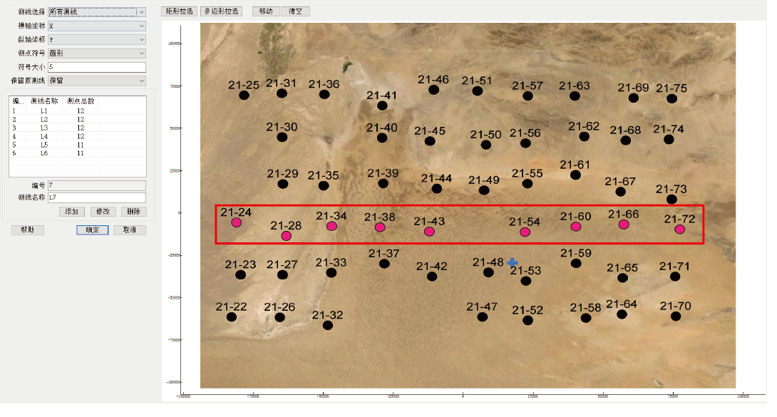
Multi-point, multi-frequency statistical analysis, obtain the correct azimuth of the electrospindle.
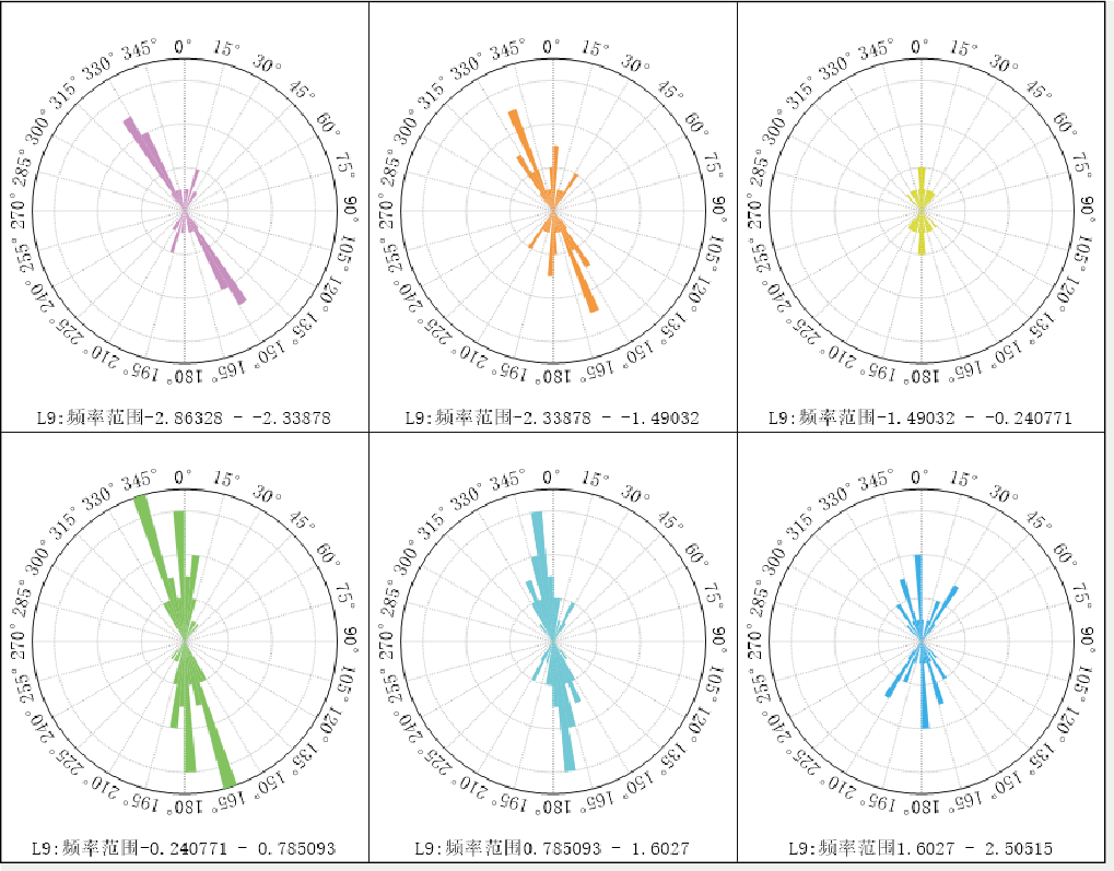
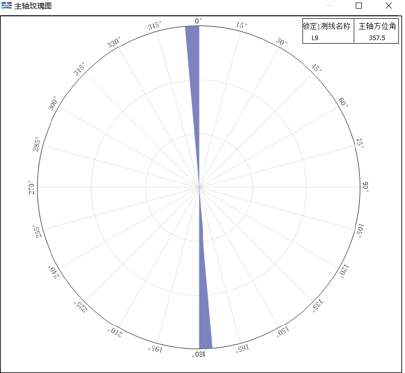
Decomposition of impedance tensor Electrical spindle
2DMT Mesh Division & Forward and Inversion
2DMT forward and inverse algorithm is optimized Occam. Initial model of forward computation is create by human-computer interaction finite element division method.
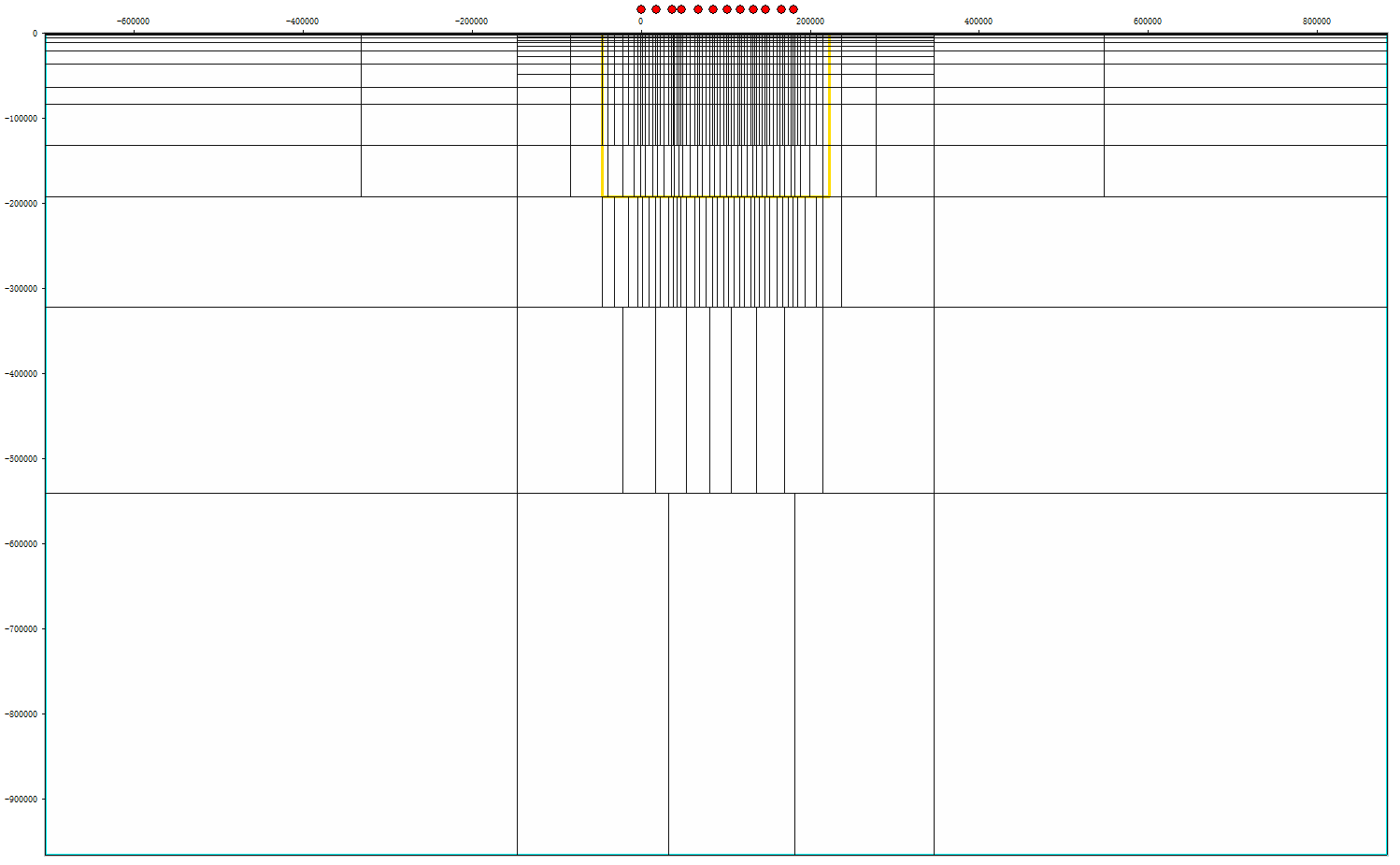
Human-computer interaction finite element division (including mesh merging and splitting)
2DMT Modeling with Geological Constraint
优化1-9f1f9ac6-a195-459b-91d7-6e8126a35002.png)
剖分效果-f2a208f2-fb36-4a4a-9ad4-c95ad7e421b5.png)
Contraint modeling with geology and drillhole data
2DMT Forward and Inversion
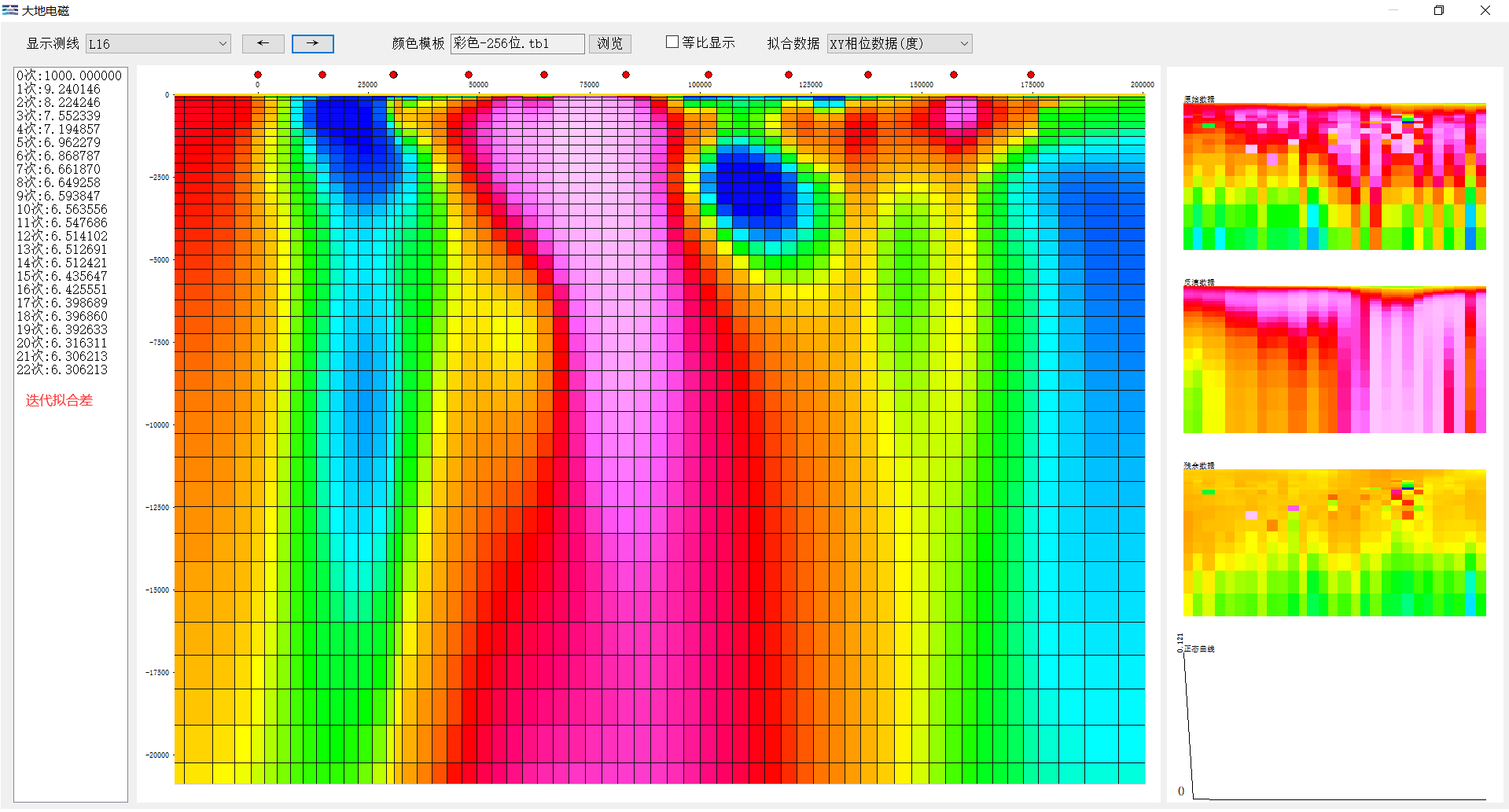
2DMT inversion results
2D Inversion Result Display
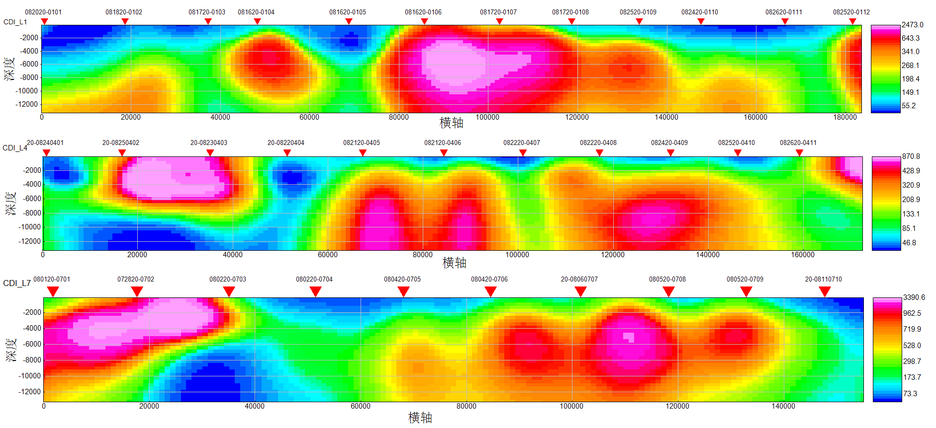
Multi-line 2DMT forward and inversion results
3D Display

3D visualization of multi-line 2DMT inversion results
Feature of 2DMT Forward and Inversion
1. The process of electromagnetic data processing is clear, the operation is simple and convenient, and it complies with industry norms.
2. The supporting functions of the electromagnetic module include data input, data sorting, quality control, data smoothing, forward and inversion processing, profile map drawing, and various three-dimensional map display of various electromagnetic instruments.
3. The inversion results are stable and can reflect more detailed information.
Case 1
Work Area Overview
This work area locates in the piedmont fault zone of the Taihang Mountains in Hebei Province. The structural line strikes mainly NNE and is cut by NW and EW faults.


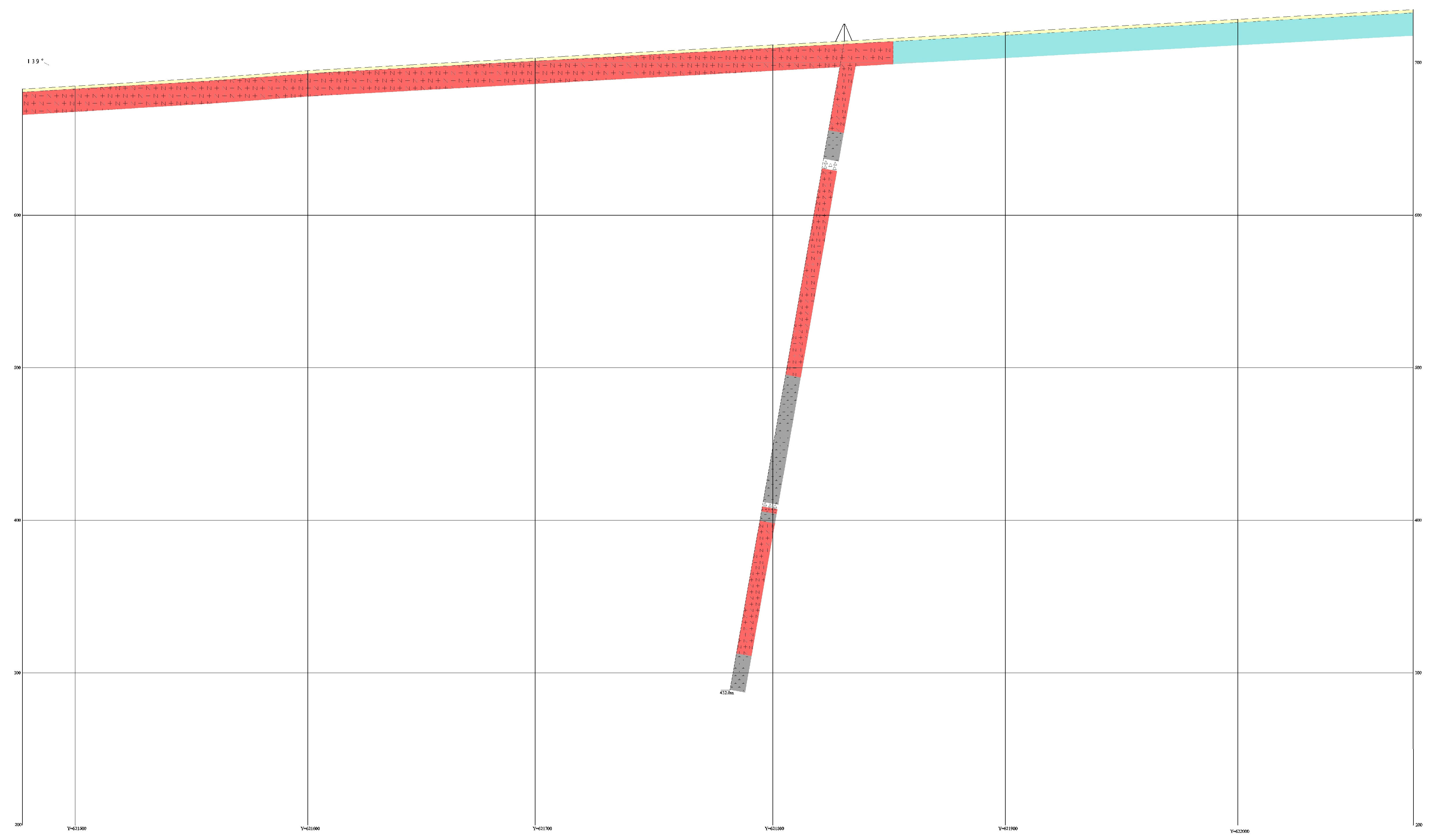
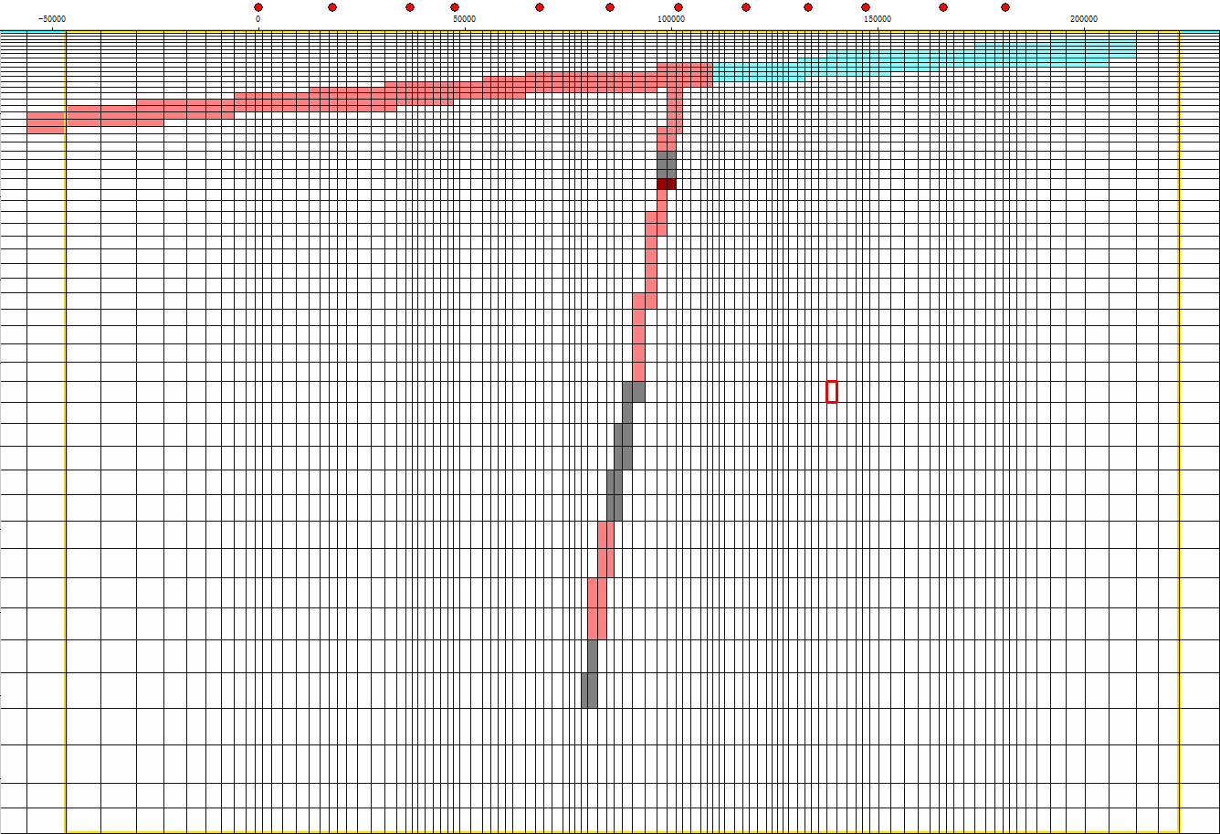
Plan view of survey line Meshing
Results of interpretation:
Fault Type: Inferred reverse fault; Fault Apparent Dip : southwest; Fault Depth: 4-5km; Fault displacement: 100~300m; The interpreted fault in the inversion results are consistent with the geological faults in the plan view.


Inversion results Mutual verification of geological information and interpretive faults
Case 2
According to the collected geology data, the cover layer in the work area is the Quaternary slope residual layer coarse breccia; the underlying bedrock is the Upper Triassic Adula Formation sandstone, mudstone intercalated with carbonaceous shale and carbonaceous mudstone. The survey area is a monoclinic structure with developed joints and fissures and broken rock mass.
According to the results of electrical inversion, the tunnel section is interpreted, the electrical grades of surrounding rocks are divided, and the section is divided into three areas: III, IV, and V. Area III represents relatively broken and weak rock mass, and area IV represents broken and weak rock mass or water-bearing rock mass, Area V represents extremely broken, extremely weak or water-rich rock mass. Low-resistance abnormal V area is fragile in lithology, geological disasters may occur during tunnel survey and construction, and it is not easy to stabilize the tunnel, and follow-up work needs to focus on.

Inversion result
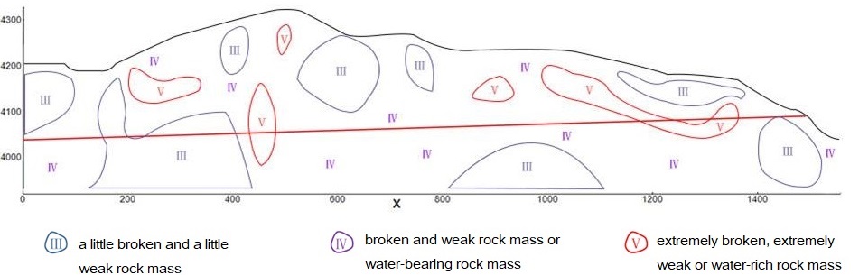
Interpretation result
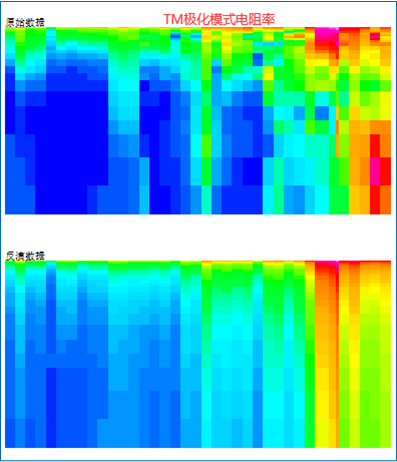

TM mode resistivity fitting results TE mode resistivity fitting results
Case 3
The survey area is located in the southeastern of Yunnan Provice, and the oldest exposed stratum is the Sinian System, which is a very thick continental slope deep-water clastic sedimentary assemblage, overlying the Lower Cambrian neritic clastic sediments.


版权所有:北京金浩林勘探技术有限公司 京ICP备12050676号
公司地址:北京市海淀区苏州街49号院7号楼610/616室 联系电话:010-62611285 服务投诉电话:13521903951 传 真:010-62611285 公司邮箱:sale@horinexplore.com
 Current Position:
  客服
客服