 Software
Geoscience Database
All kinds of professional data become clear and concise here, and maps and data correspond one by one, and everything is clear at a glance.
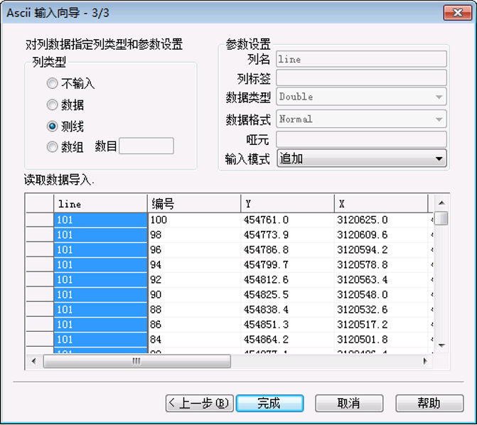

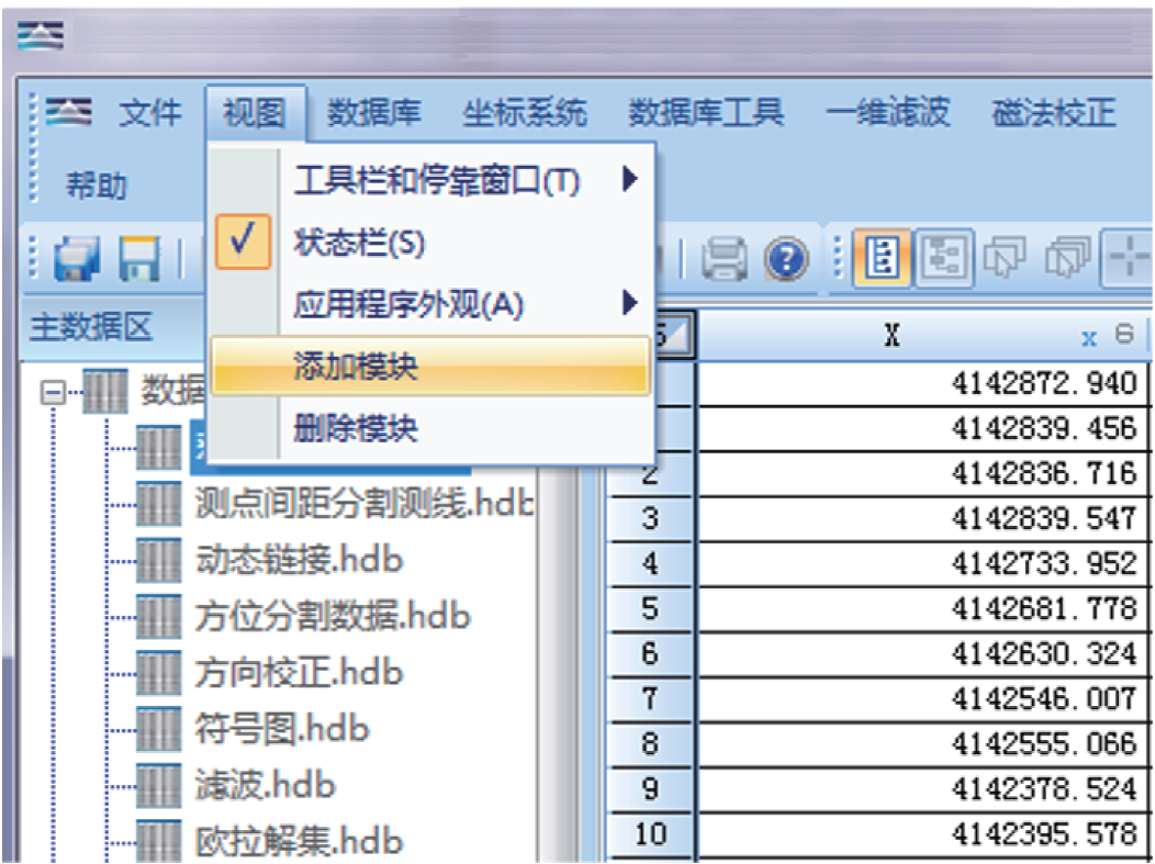
Support Various Instrument Data Format Import Database Management System
Coordinate System Coversion
Horin coordinate projection includes various coordinate projection parameters around the world, supports common projection methods such as WGS84. It can also customize projection parameters to meet the projection needs of different regions.

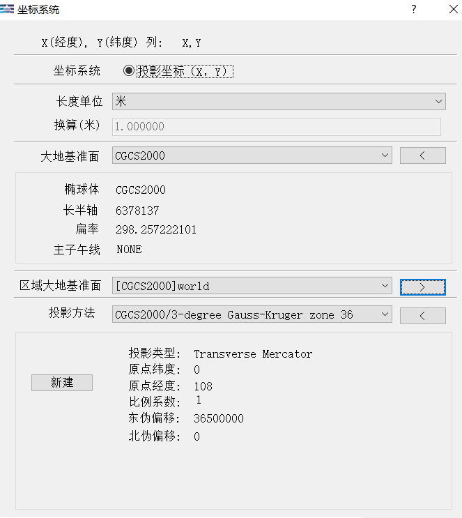
Professional Coordinate Projection
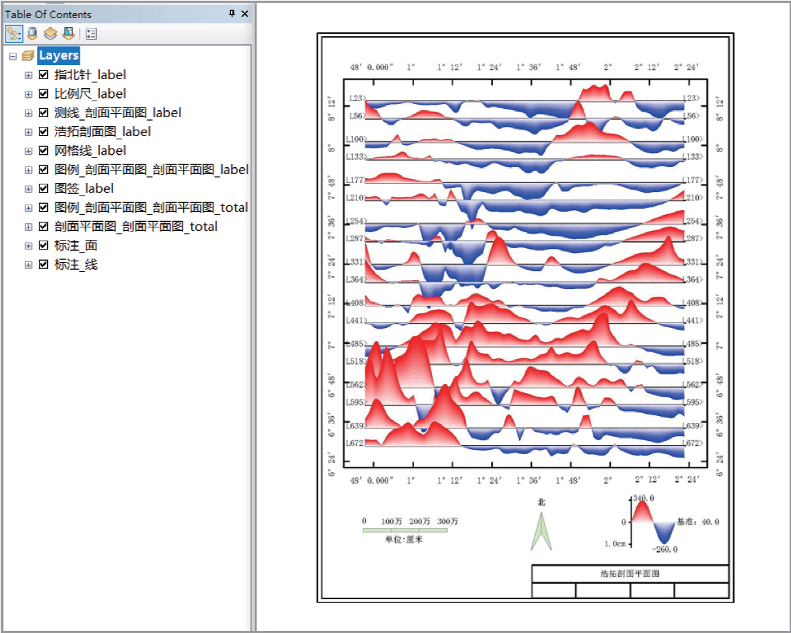
Grid Map & Multi-layer Plan Map System
Professional geoscience mapping, make your results display more professional and detailed.
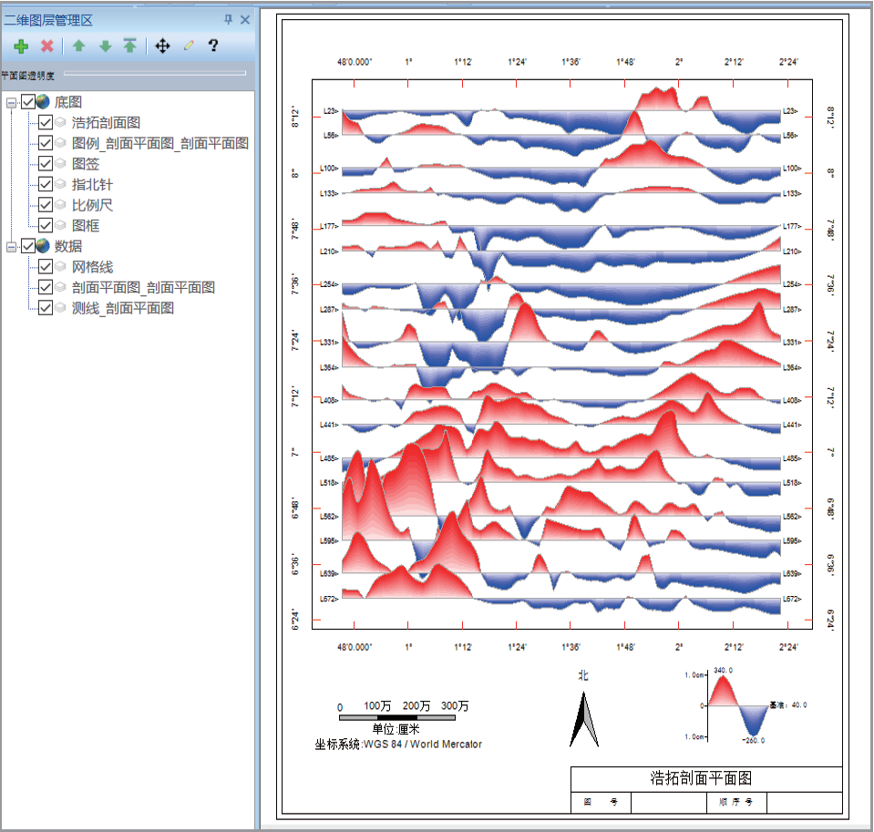
Profile Map
Profiles of different styles show professional style.

Comprehensive Mapping
Drawing different types of maps together is convenient for comprehensive comparison and analysis. It can also be printed out as a comprehensive result map.
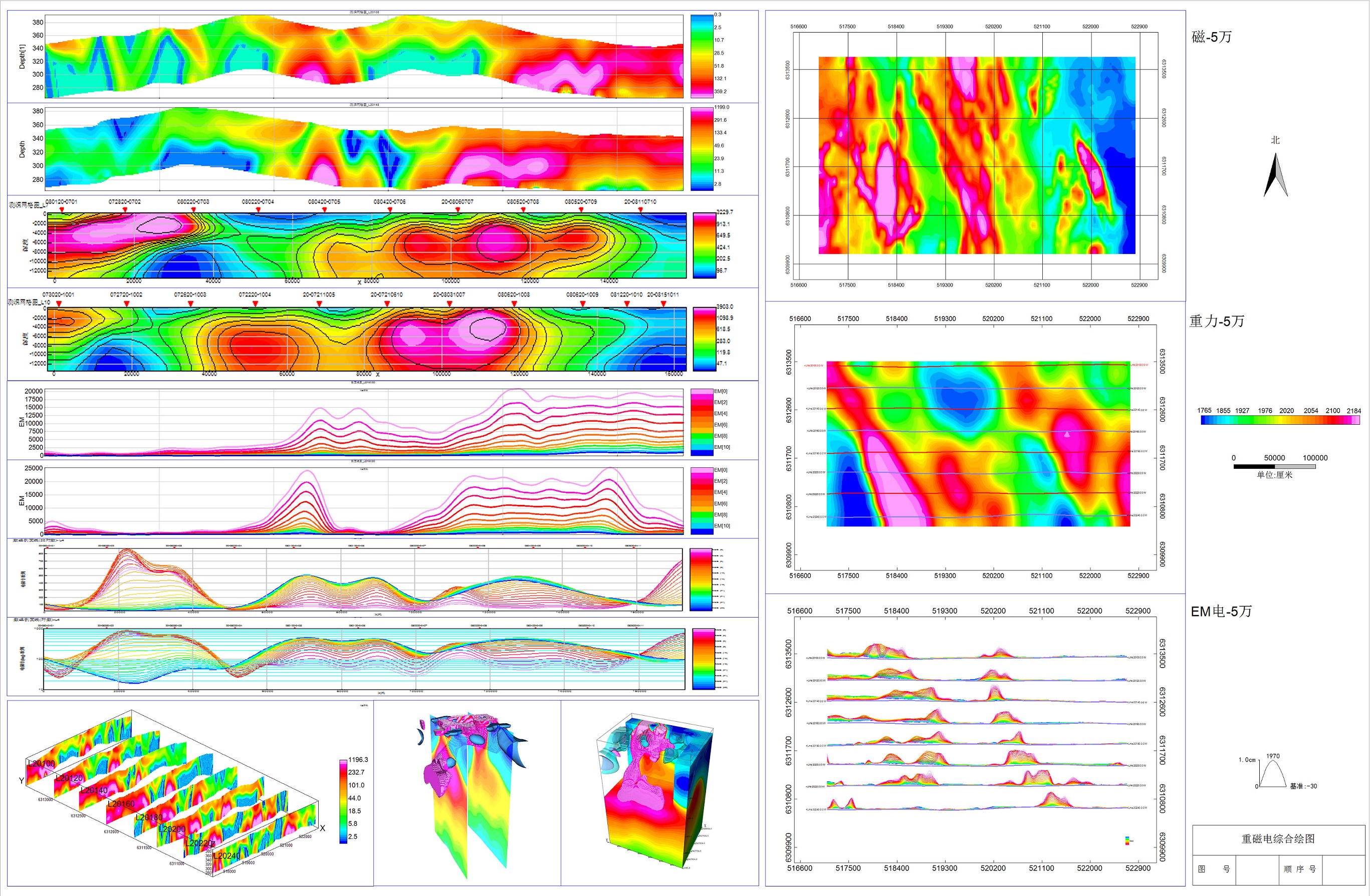
Integrated Mapping of Geoscience Data
3D Voxel Mapping
Make 3D data clearly displayed to partners in any way you want.

3D Drillhole System
Display drilling survey, lithology, and assay data to the partner in the most concise and clear way, so that the party can instantly understand the greatness of your work.
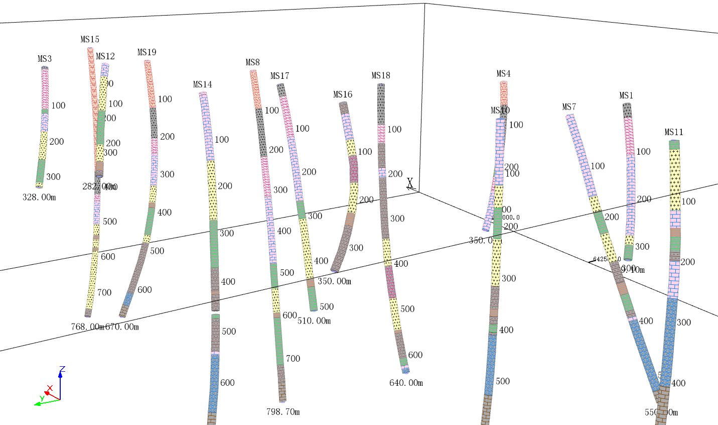
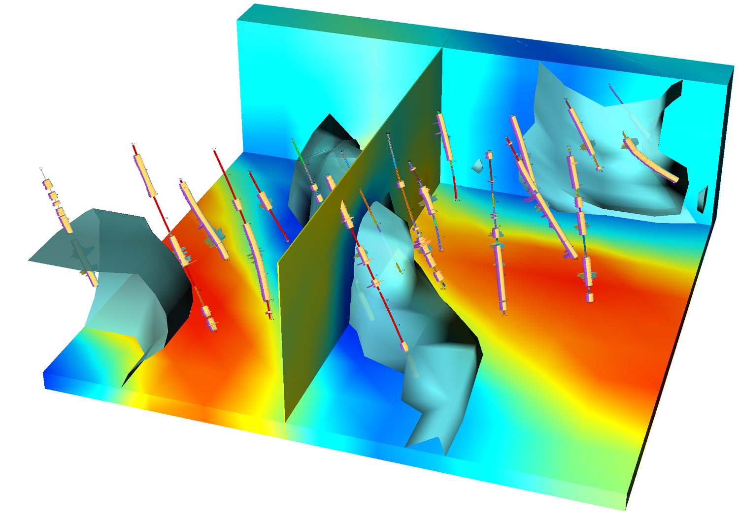
Drillhole Data-Lithology Comprehensive Display-Assay, Voxel and Isosurface Comprehensive Display-Assay and Isosurface
Geoscience Data Collation Tools
Statistics, analysis of data, and elimination of tares have become easy and simple.
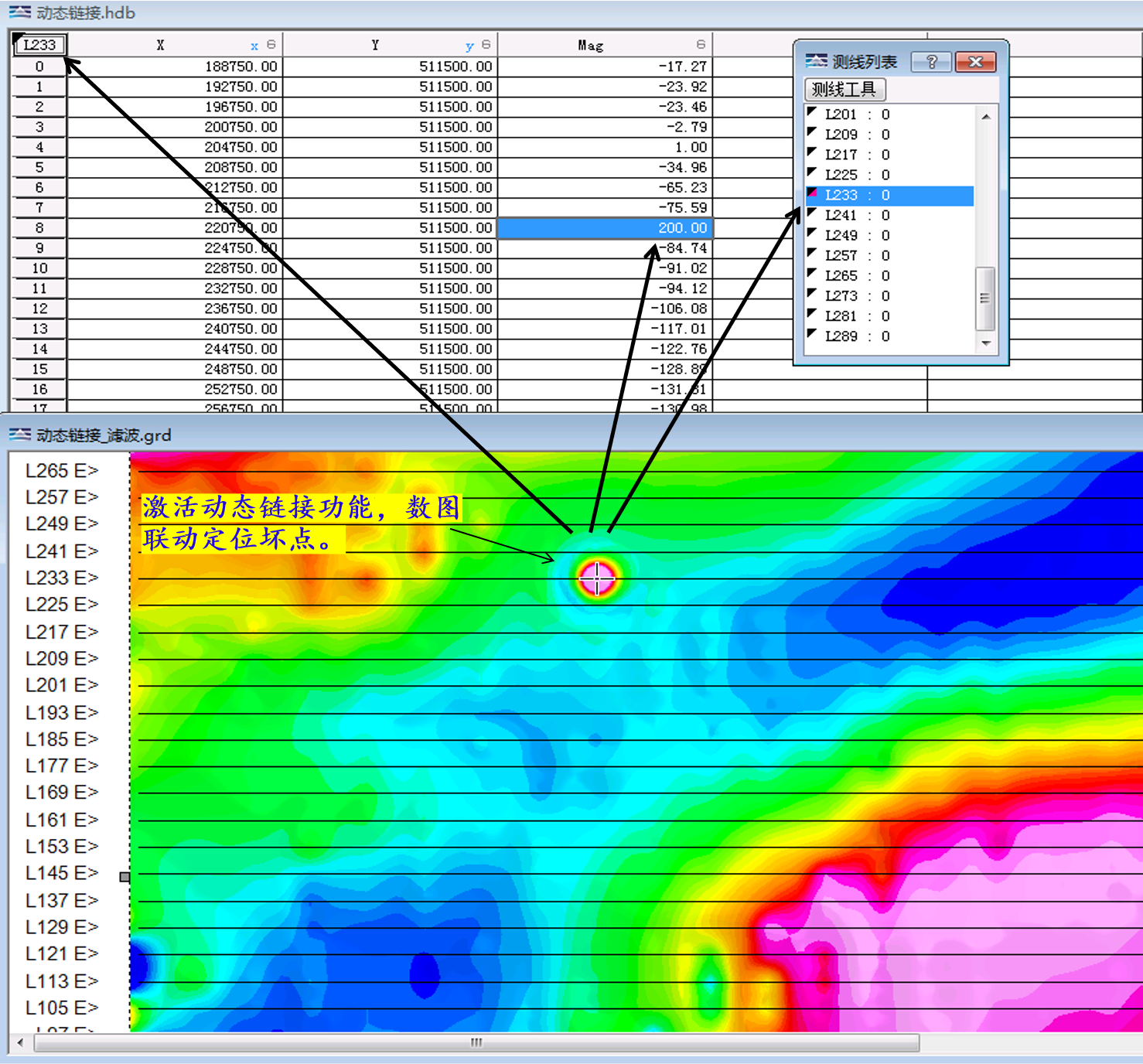
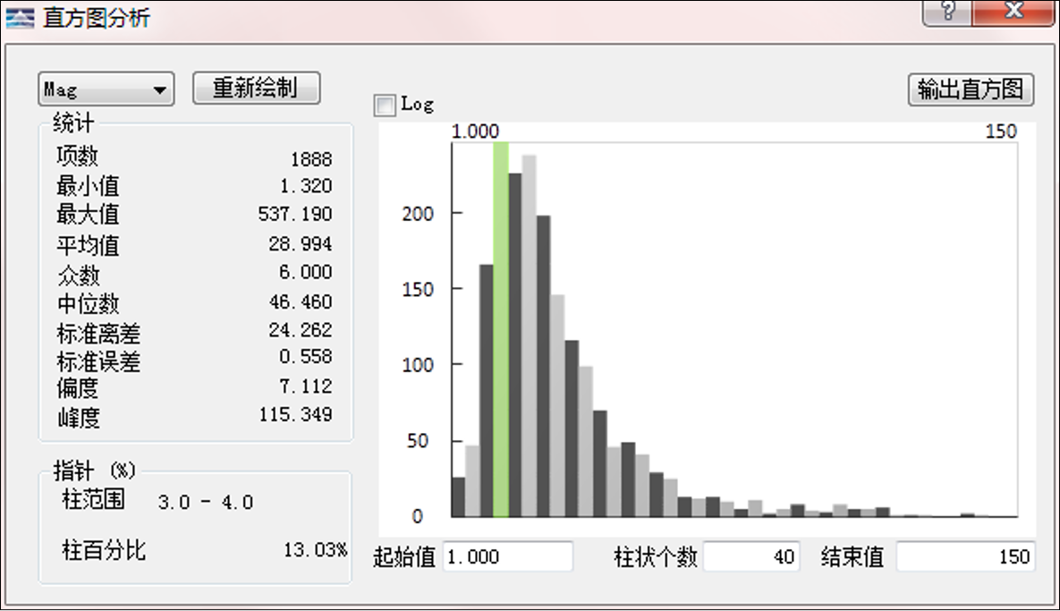
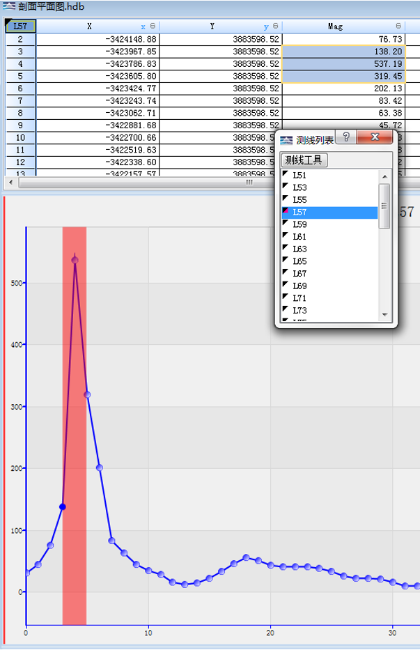
Plan Map and Data Linkage Statistical Analysis Tool Profile Curve and Data Linkage
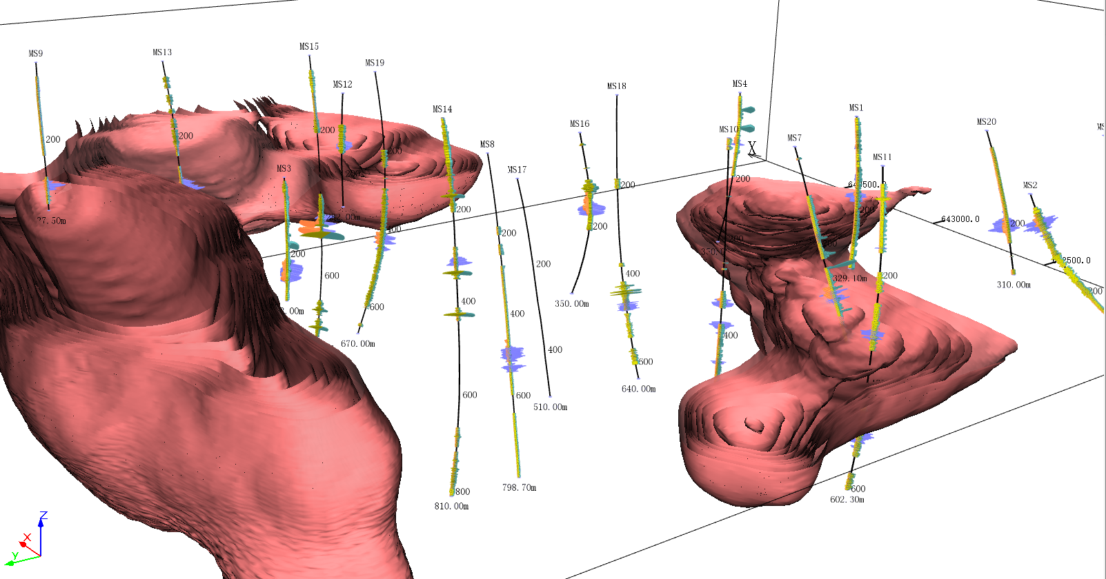
3D Vector Model & Comprehensive Model Mapping
Display the geological structure data in a clear and intuitive 3D manner, which makes communication easier.

Horin 3D Comprehensive Display
Image Format Transform
Support a variety of common data and image output.

Horin Stacked Profile Export ArcGIS Format Export MapInfo Format
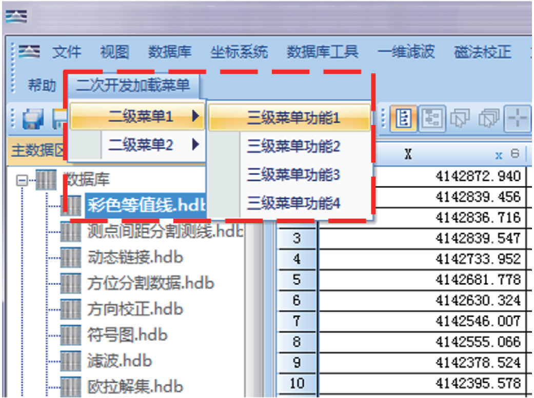
Secondary Development
By the way, add your own programs to Horin Geoscience Mapping Software to make your work more unique. No matter what language your program is written in, it can be easily added to Horin software.
版权所有:北京金浩林勘探技术有限公司 京ICP备12050676号
公司地址:北京市海淀区苏州街49号院7号楼610/616室 联系电话:010-62611285 服务投诉电话:13521903951 传 真:010-62611285 公司邮箱:sale@horinexplore.com
 Current Position:
  客服
客服