 Software
Aeromagnetic Module
Advantages:
Support the import and export of big data in various formats, and easily import a single file with a size of 5GB.
Fast batch processing of tares in aeromagnetic data and matching of GPS coordinates.
There are up to ten kinds of line splitting methods, which can quickly split and number the aeromagnetic data.
System leveling, statistical leveling and single-point leveling, and various professional leveling methods make the treatment effect better.
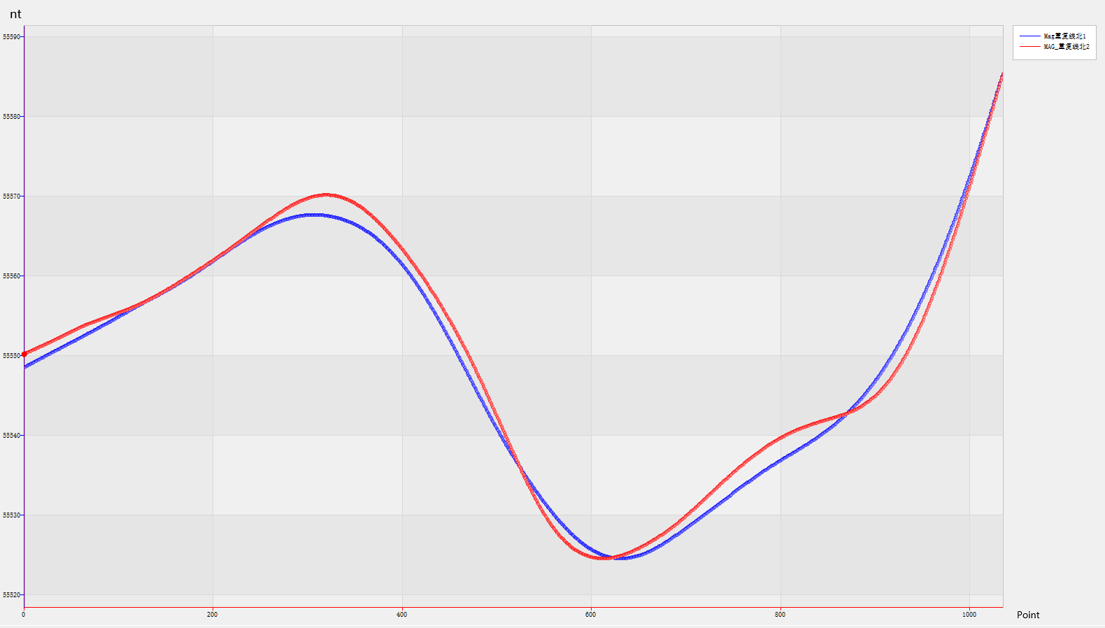
The linkage of profile curve and database enable you to grasp the quality of field flight data in real time.
Built-in digital graph management systemcan realize arbitrary switching and dynamic linking between data and graphs, with unprecedented efficiency.
We have only done one thing in the past 15years, that is, with high-quality products and the most professional technical support to make you feel at ease in buying and comfortable in using.
Database & Map Management System
Professional geophysical database and multi-layer mapping system, perfect data collation tools and coordinate system, and linkage function between data and map make your data collation extremely clear and simple, and you can easily extract/match the specified data or map in the project. Professional digital mapping system makes your work efficiency achieve a qualitative leap.

Data Statistics
Horin Geophysical software can automatically generate various PDF statistical reports based on data, such as data collection system quality statistics, workload statistics, flight duration statistics,
flight altitude statistics, yaw distance statistics, dynamic horizontal noise statistics, magnetic diurnal variation data statistics, etc.
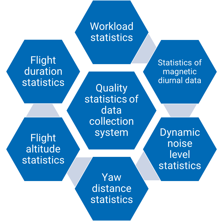
Aeromagnetic data statistics
Two Coloring Modes for Grid
It provides two coloring modes for grid: pseudo color and color block filling.
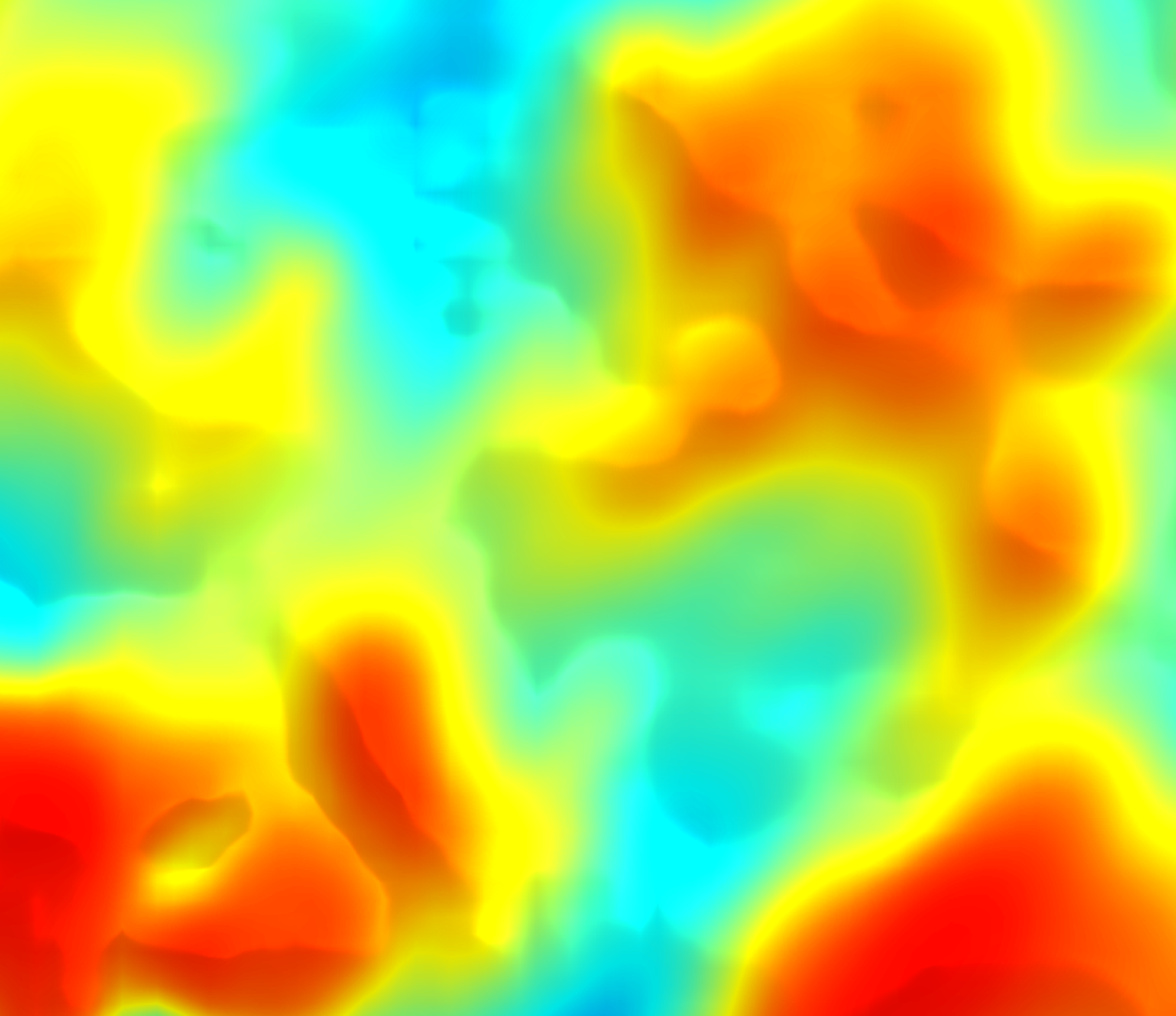
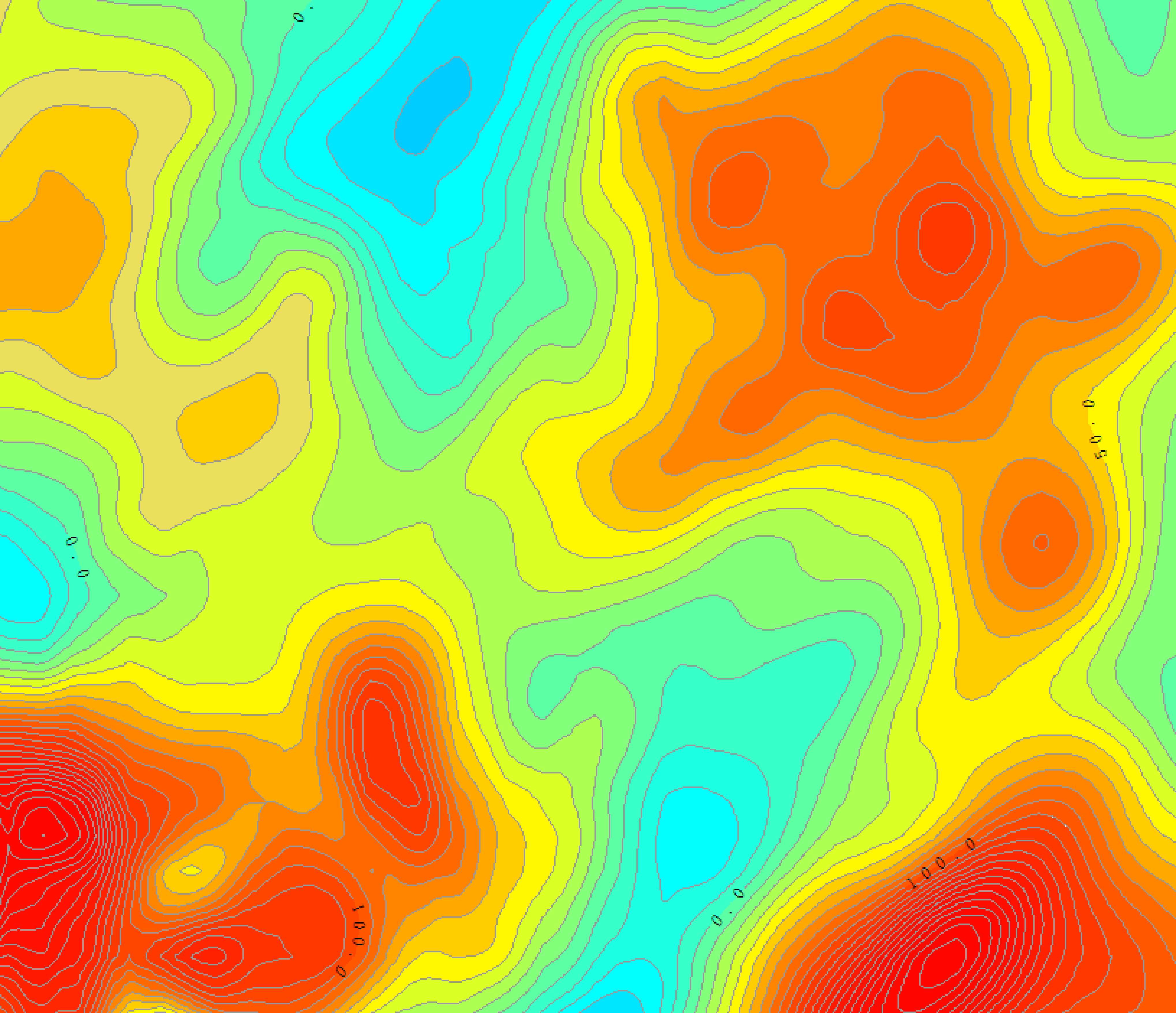
Pseudo color effect Color block filling effect
Batch Processing of Massive Tares
Aeromagnetic data is large, and the dataacquisition interval is in seconds. Manual tare elimination is inefficient andprone to errors. Horin Software provides the batch processing function of tares,which can process the data with a size of several GB in batches by human-computer interaction, and delete, resample or optimize the massive tares.Turn a week's tedious work into a lift a finger.
The amount of aeromagnetic data is large,and the data acquisition interval is in seconds. The manual removal of badpoints is inefficient and error-prone. Horin software provides the batch processing function of bad points, which can process the data of several GB inbatches by human-computer interaction, delete, resample or optimize the massivebad points. Turn the week 's complicated work into a labor of hands.
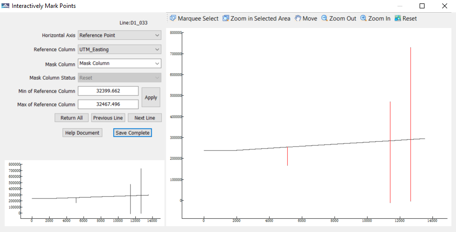
Interactively mark points
Evaluation of Repeated Line Measurement Accuracy
With the help of the powerful Horin Geophysical Database, the accuracy of magnetic data of multiple groups of repeated lines can be calculated and evaluated simultaneously. Data quality evaluation can be completed at the job site.

Repeated line measurement Repeated line statistics
Quickly Obtain Data of Interest
Two methods of quickly extracting target data make it easy to integrate data:
Extraction from database: mark the area of interest in the map, then directly extract the corresponding data from the database and store it in a new database.
Extraction from grid: directly cut the grid interactively to obtain new grid data.
Data Decimation
The line spacing of aeromagnetic data is large, but the point spacing is small. In data processing or mapping, it is necessary to carry out decimating/interpolation processing of points. Horin Software provides decimating/interpolation processing function of points according to time/distance/reference column, so that you can quickly experiment to obtain the best point spacing and output the best effect grid.

Raw data point Decimate by time Decimate by distance
Grid Stitching
The program will automatically search and identify overlapping areas in multiple grids, and automatically perform grid stitching operation.
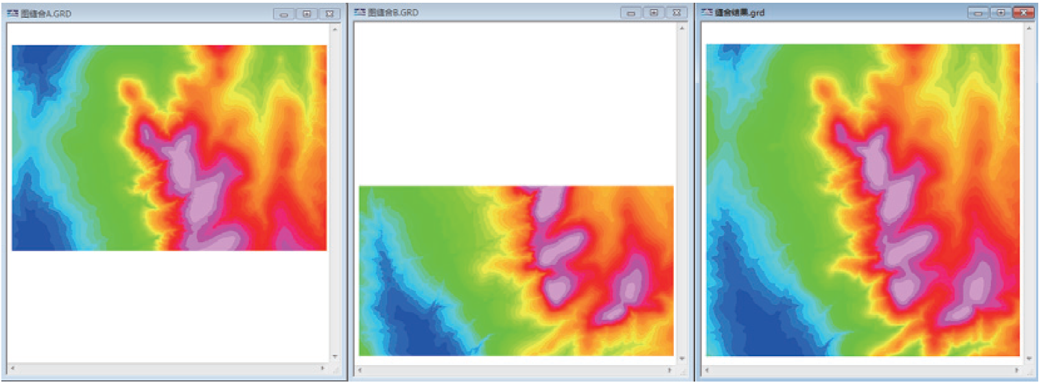
Grid stitching (position synchronization)
Quick Matching of Data
Horin Software provides a professional data matching function, which can extract the target column from the specified database (or grid data) according to the reference column, coordinate column ortime column in the raw database. The target column can be coordinates, terrain, magnetic value, or other property values. From then on, it is no longer aproblem to match the data quickly and neatly.

A Variety of Line Quick Clipping Functions
Horin Software contains up to ten kinds of functions of splitting and numbering lines, such as splitting line by time, splitting line by preset line and Interactive split line, which makes complicated work completed in an instant.

Aeromagnetic Module
Magnetic Disturbance Separation
Horin software can quickly and accuratelyjudge the magnetic disturbance day, extract the magnetic disturbance value fromthe diurnal data by Fourier series operation, and get the magnetic calm daydata, which makes your aeromagnetic correction result different.

Magnetic Disturbance Separation
Heading Correction
Deal with the errors caused by thedifferent flight directions of the aircraft. The source of the errors is theinhomogeneity of the magnetic field of the aircraft itself, so as to make yourcorrection results better.

Generate correction files with datafrom eight directions
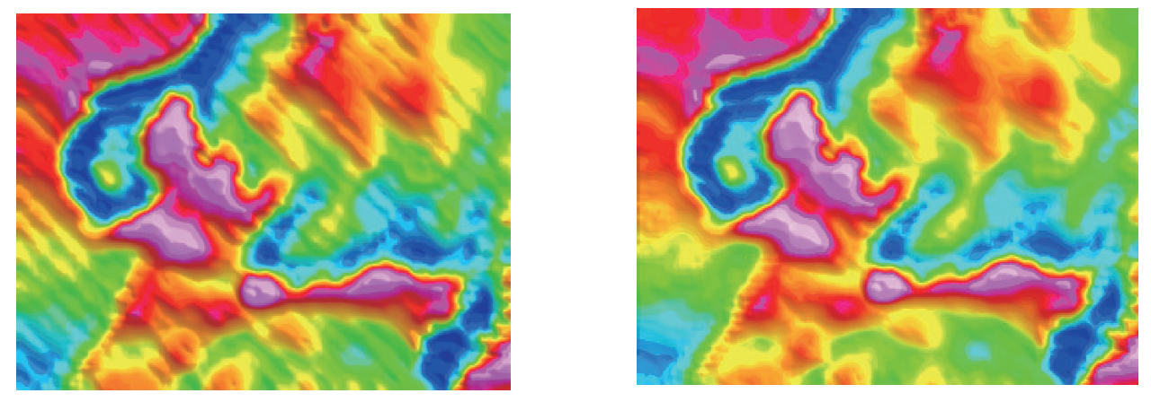
Effect before heading correction Effect after heading correction
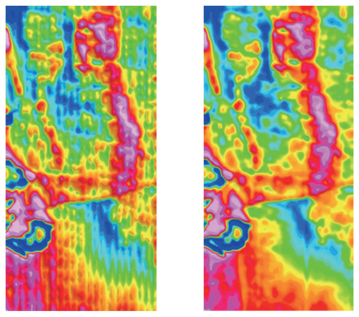
Delay Correction
Correct the error caused by the position deviation between GPS probe and measuring instrument or the time difference between GPS data and measuring data, which will make the data of adjacent lines reverse offset. This function makes your correction result perfect.

Data with delay error Corrected data
Leveling Calculation
Including "system leveling" and"statistical leveling" methods, the crossover point difference and leveling accuracy can be counted and marked in the map, global leveling can be automatically carried out, and text reports can be generated at the same time, which makes this complicated work simple, fast and high-quality, and makes your correction results reach high-quality standards.
Before leveling After leveling

Leveling statistical report generated by Horin
版权所有:北京金浩林勘探技术有限公司 京ICP备12050676号
公司地址:北京市海淀区苏州街49号院7号楼610/616室 联系电话:010-62611285 服务投诉电话:13521903951 传 真:010-62611285 公司邮箱:sale@horinexplore.com
 Current Position:
  客服
客服