 Software
Artifact Detection
Professional Data Processing System
Professional geophysical database allows you to eliminate tares and collate data with the highest efficiency, and carry out professional statistical analysis, so that your work efficiency can achieve a qualitative leap.

Professional Data Processing System
Section Anomaly Display
The observation data corresponds to theabnormal body model, and the three-dimensional coordinates and shape of theabnormal body can be obtained quickly.
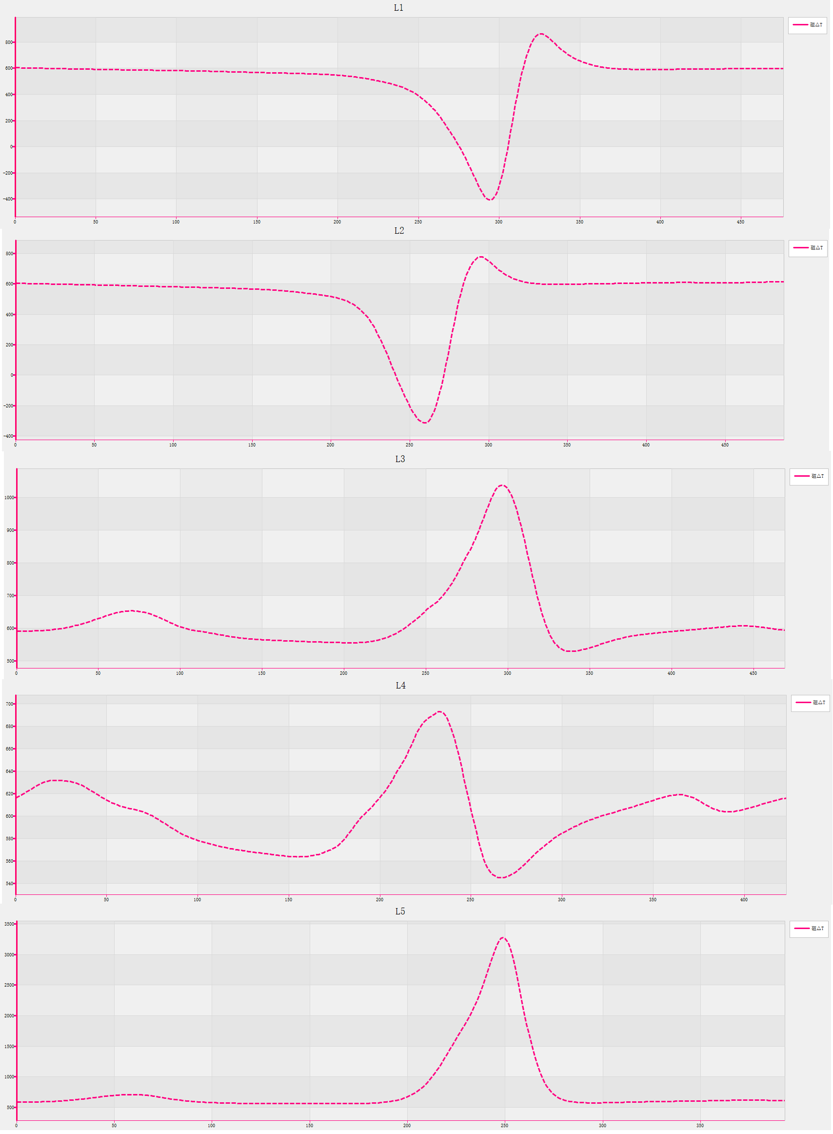
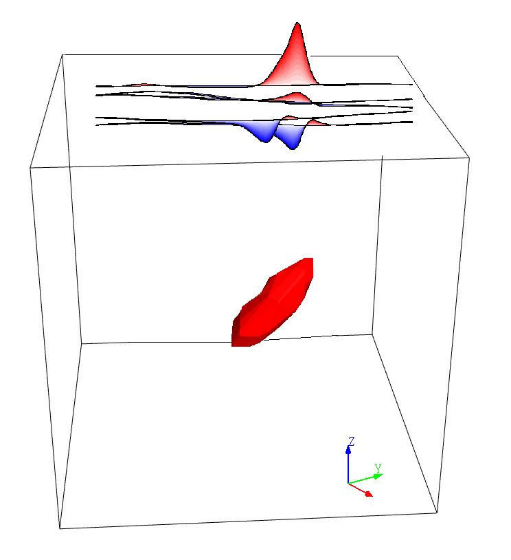
Profile curves Stacked profile map corresponding to abnormalbody
Magnetic Correction
The whole process of magnetic datacorrection processing function makes your work simpler, more accurate and moreprofessional.
Magnetic Gradient Calculation
Sensor position reduction and gradient value calculation of magnetic gradiometer, and the gradient data processed professionally make your detection results have unique accuracy and clarity.


Calculate the positions of each sensor of three-axis magnetic gradient meter Draw the trace of each sensor
Potential Field Transformation Processing
Professional geophysicalone-dimensional/two-dimensional potential field transformation calculationfunction, what you see is what you get, efficient and professional.

2D Filters Comparison before and after upwards continuation 100 meters

3D Quick Inversion
Euler three-dimensional inversion can directlyand quickly locate the three-dimensional coordinates of abnormal bodies, andyou can get professional qualitative interpretation results immediately byyourself.

Artifact Detection
Practical Case 1: Submarine Oil Well Exploration
The magnetic gradient data of the ship isprofessionally processed by the Horin Artifact Detection module, and asubmarine oil well is clearly and accurately located.

Practical Case 2: Archaeological Shipwreck Detection
The total magnetic field data of the shipis used to detect underwater shipwrecks. After the professional processing of HorinArtifact Detection module, three obvious anomalies with good aggregation areobtained, and the middle anomaly position is confirmed as a modern shipwreck.
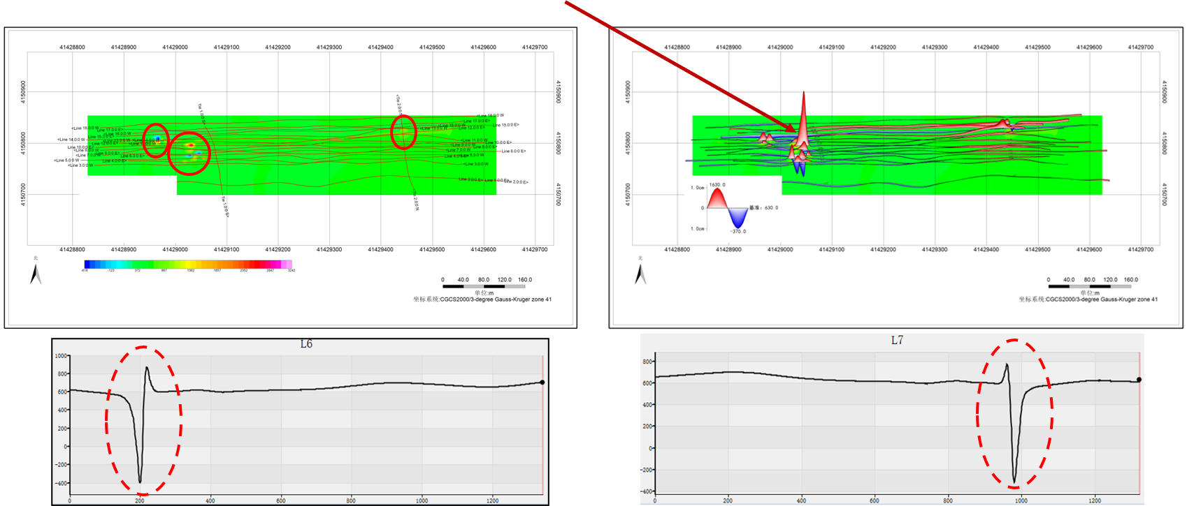
Practical Case 3: Unexploded Ordnance Detection
The total magnetic field data on land isused to detect unexploded ordnance in soil layer. After being processed by HorinArtifact Detection module and interpreted by Euler three-dimensional inversion,many unexploded ordnances are clearly and accurately located.


版权所有:北京金浩林勘探技术有限公司 京ICP备12050676号
公司地址:北京市海淀区苏州街49号院7号楼610/616室 联系电话:010-62611285 服务投诉电话:13521903951 传 真:010-62611285 公司邮箱:sale@horinexplore.com
 Current Position:
  客服
客服