Horin Software
Current Position: Home > Horin Software > Horin Software
Geoscience Mapping Software

Horin Geoscience Mapping Software is a set of general geoscience data collation and mapping software, which can be used for land, air, ocean surveying and geophysical surveys, as well as other related professional data collation, mapping and 3D geological modeling work. It contains eleven types of basic general functions, which can meet your daily work needs for geoscience data collation and map display to the greatest extent. Horin Geoscience Mapping Software is a mature industry standard software. High-quality training and technical support can help you get started quickly, and the secondary development interface allows you to add your own programs for collaborative use; choosing our products and services, you can greatly improve team work efficiency and optimize work results. What's more important is the simple operation of Horin Geoscience Mapping Software, you can apply for a trial experience now. (Trial WeChat: 13521903951)


Data Collation and Map System

Data collation and map system is the core module of Horin software. It includes following functions: data collation, coordinate system, gridding, multi-layer map, symbol library and 3D geological modeling. There is a good independence between the functions. You can use every function individually or combined use, which greatly improves your work efficiency.

Filtering

The meaning of filtering is to separate or highlight the abnormal information. Horin software specially designed one-dimensional geophysical filters module and two-dimensional filters module.

Magnetic Correction

There are 9 kinds of magnetic corrections,which are completely designed according to the industry standard.


Gravity Correction

There are 11 kinds of gravity corrections, which are completely designed according to the industry standard.


3D Gra & Mag Forward & Inversion

Horin software provides you with a set of professional gravity and magnetic 3D inversion tools "Euler 3D inversion calculation", which uses the Euler homogeneous equation to solve the 3D-coordinate of field source. This tool makes your geophysical interpretation job become more easy and efficient.

Electrical Basic Module

Basic module includes inputting and outputting of various EM instruments data, electrical spindle statistical analysis, decomposition of impedance tensor, QA/QC and error bar drawing, data smoothness, 1DMT inversion, CDI/3D-view and comprehensive map drawing, etc. 

2DMT Forward and Inversion

2DMT modeling and inverse module adopts finite element and Occam optimization calculation methods. You can generate profile and comprehensive map by the results of inversion in Horin software early.


3DMT Forward and Inversion

3DMT modeling and inversion module uses the 3D constraint geologic model as the starting model, perform 3D inversion calculation by nonlinear conjugate gradient algorithm. High quality 3DMT inversion can be completed on PC in a few days.


Aeromagnetic Module

Horin Aeromagnetic Data Processing Module is suitable for processing the magnetic data surveyed by unmanned aerial vehicles and manned aircraft. It can efficiently complete the import, quality control, correction and mapping of aeromagnetic data. With complete functions, complete workflow and mature and friendly interface, it can ensure that you can process the raw data into high-quality submission results in a software environment, and at the same time, we also provide function customization services to help you achieve your own special functions. Horin Software will definitely make your work efficient and high-quality. Welcome to try it out and contact us for free pre-sales training.


Artifact Detection

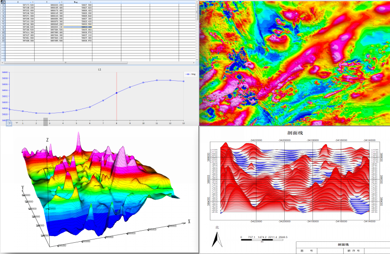
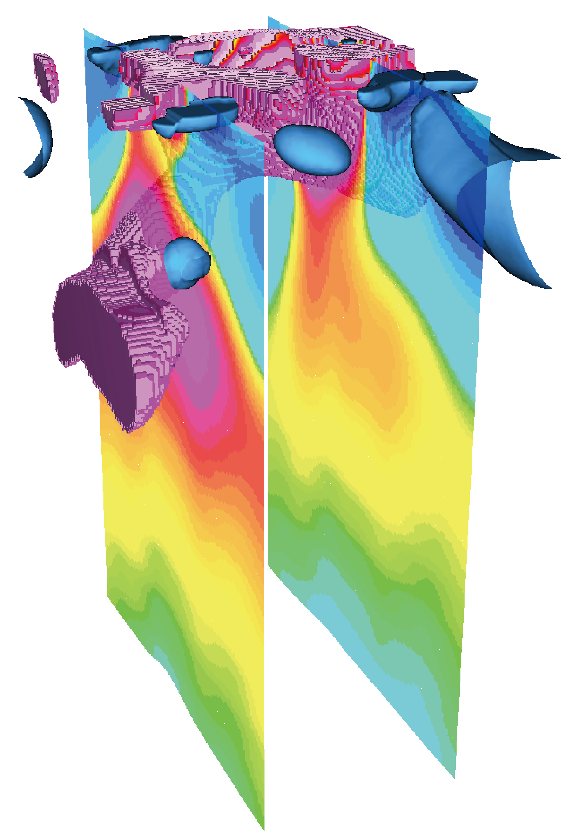
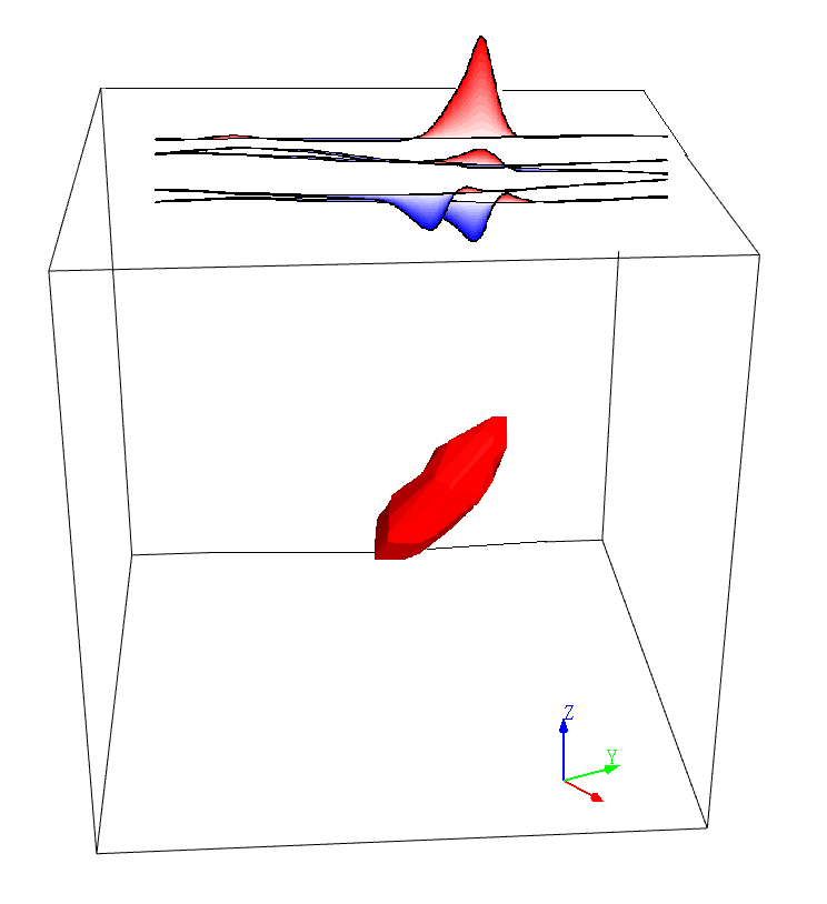
“Artifact Detection” is a professional module specially used for artificial object detection in Horin GeophysicalSoftware, which includes four functional parts: magnetic data collation, processing, correction and interpretation. It is suitable for total magnetic field data and magnetic gradient data, allowing you to obtain the most professional and accurate processing and interpretation results.

This module can be used in many fields, such as archaeological detection, unexploded ordnance detection, submarine artifact detection, pipeline and cable detection, environmental investigation, etc. Through the professional processing and interpretation of magnetic data collected on site, the position, size and shape of underground magnetic artifacts can be quantitatively identified, and the  underground/underwater artifact targets can be quickly and accurately located.


版权所有:北京金浩林勘探技术有限公司  京ICP备12050676号

公司地址:北京市海淀区苏州街49号院7号楼610/616室   联系电话:010-62611285   服务投诉电话:13521903951   传    真:010-62611285   公司邮箱:sale@horinexplore.com